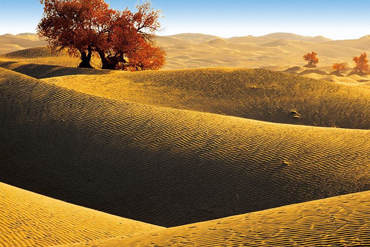
What Was China's Silk Road?
The Silk Road was the world’s most significant trade route that connected East and West for two thousand years.
It started in the Yellow River basin where China’s first civilizations developed. From ancient Chinese capitals, Xi’an and Luoyang, it passed through the arid Gansu Corridor and remote west of China, and beyond to Central Asia and Europe.
The Significance Of The Silk Road
Trade and travel between east and west caused revolutionary changes in everything from culture, religion, and technology to the emergence of huge empires and the disappearance of many small tribes, kingdoms, and empires.
The inventions of paper and gunpowder in China were so powerful that when the technology reached Europe, it enabled the Renaissance, the Protestant Reformation, and the scientific and industrial revolutions that transformed the world. Paper enabled rapid publication, and gunpowder weapons changed warfare and enabled the destruction of older empires and the emergence of new nations. Plagues spread and destroyed half the population in large regions of Eurasia and new crops and technologies allowed the population in Eurasia to grow rapidly. The Mongol invasions on the Silk Road routes imprinted Mongol ethnicity and language from Xinjiang to Eastern Europe. Two of China’s major religions, Buddhism and Islam, were introduced mainly via the Silk Road.
Recommended Route
Shaanxi — Gansu — Ningxia — Qinghai — Xinjiang
Must-see Along The Route
01. Shaanxi Province
Shaanxi, “Qin” for short, is located in the inland of China’, and is an important hub connecting the eastern and central regions and the northwest and southwest of China.
The territory of Shaanxi is narrow. The terrain is high in the north and south, low in the middle. From north to south, there are three landforms including Shanbei Plateau, Guanzhong Plain, and Qin-Ba Mountain. The main mountains include the Qinling Mountains, the Daba Mountains and so on.
Shaanxi stretches across three climatic zones, and the climate in the north and south is quite different. The temperature decreases from south to north and from east to west. The rainfall is more in the south than in the north. Shannan is a humid region. Guanzhong a semi-humid region, and Shanbei a semiarid region.
The province belonged to the Yongzhou and Liangzhou in ancient times, also known as the “Land of Three Qin.” With a long history, it is ancient and mysterious, known as “the natural history museum.” The Terracotta Warriors and Horses, Famen Temple, Xi’an City Wall and other cultural relics can all be found here. There are 72 ancient imperial tombs here.
Shaanxi folk culture is splendid and rich and includes the Shaanxi shadow play, Qinqiang, Shanbei Yangge, Shaanxi puppetry, Ansai waist drum, as well as Shaanxi farmer painting, Ansai paper-cutting, Dali crispy noodles, Ganjing Town crispy noodles and other folk arts.
- Terracotta Warriors and Horses in Xi'an the capital city of Shaanxi Province
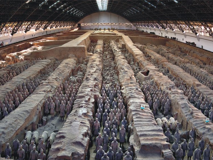
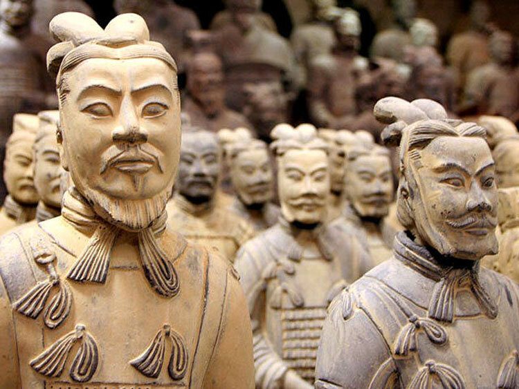
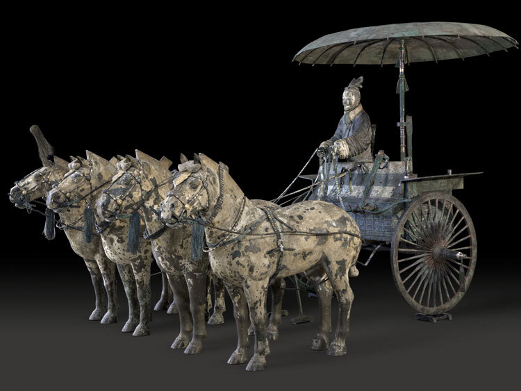
The Terracotta Army isn’t just Xi’an’s premier sight: it’s one of the most famous archaeological finds in the world. This subterranean life-size army of thousands has silently stood guard over the soul of China’s first unifier for more than two millennia. Either Qin Shi Huang was terrified of the vanquished spirits awaiting him in the afterlife or, as most archaeologists believe, he expected his rule to continue in death as it had in life. Whatever the case, the guardians of his tomb – who date from the 3rd century BC – today offer some of the greatest insights we have into the world of ancient China.
The discovery of the army of warriors was entirely fortuitous. In 1974 peasants drilling a well uncovered an underground vault that eventually yielded thousands of terracotta soldiers and horses in battle formation. Throughout the years the site became so famous that many of its unusual attributes are now well known; in particular the fact that no two soldier’s faces are alike.
- Terracotta Warriors and Horses in Xi'an the capital city of Shaanxi Province
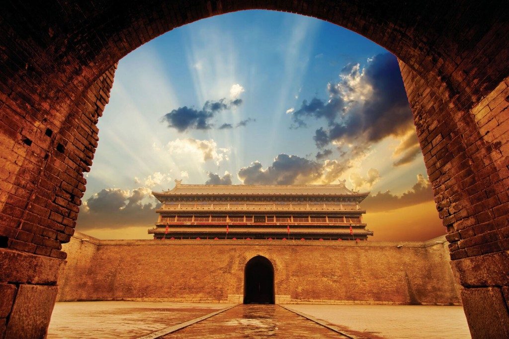
Xi’an is one of the few cities in China where the imposing old city walls still stand. Built in 1370 during the Ming dynasty, the magnificent 12m-high walls are surrounded by a dry moat and form a rectangle with a perimeter of 14km. Most sections have been restored or rebuilt, and it is possible to walk the walls in their entirety in a leisurely four hours (or around two hours by bike, or at a slow jog).
You can cycle from the South, North, West and East gates, with rental costing ¥45 for 100 minutes (¥200 deposit), while the truly lazy can be whisked around in a golf cart for ¥200. Access ramps are located inside the major gates, with the exception of the South Gate, where the entrance is outside the walls; there’s another entrance inside the walls beside the Forest of Stelae Museum. En route, you get to look out over modern-day Xi’an.
From this vantage point it’s clear that the city is a hotchpotch of the old and new, with the new vastly in the ascendancy. Every now and then a slice of old Xi’an, such as Guangren Temple, appears and you are rewarded with a bird’s-eye. To get an idea of Xi’an’s former grandeur, consider this: the Tang city walls originally enclosed 83 sq km, an area seven times larger than today’s city centre.
- Hukou Waterfall
The Hukou Waterfall is the largest waterfall on the Yellow River, the second largest waterfall in China (after the Huangguoshu Waterfall in Guizhou), and the world’s largest yellow waterfall. It is located at the intersection of the provinces of Shanxi and Shaanxi, 165 km (103 mi) to the west of Fenxi County, and 50 km (31 mi) to the east of Yichuan County where the middle reaches of the Yellow River flow through Jinxia Grand Canyon. The width of the waterfall changes with the season, usually 30 metres (98 ft) wide but increasing to 50 m (164 ft) during flood season. It has a height of over 20 m (66 ft). When the Yellow River approaches the Hukou Mountain, blocked by mountains on both sides, its width is abruptly narrowed down to 20–30 m (66–98 ft). The water’s velocity increases, and then plunges over a narrow opening on a cliff, forming a waterfall 15 m (49 ft) high and 20 m (66 ft) wide, as if water were pouring down from a huge teapot.
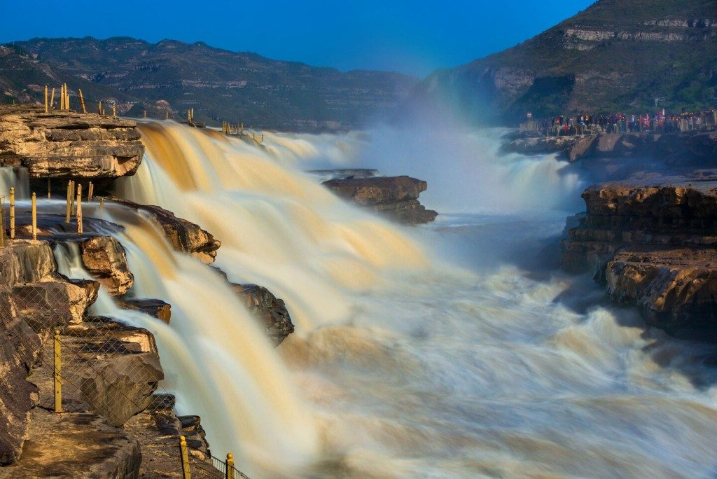
Hence it gets the name Hukou (literally, “flask mouth”) Waterfall. Just below the waterfall, there is a shining stone called guǐshí (鬼石). What makes the stone mysterious is that it moves up and down according to the water level. No matter how large the water volume, it is still at least partly visible. In the middle of the river, about 3,000 m (9,843 ft) from the Hukou Waterfall, an enormous rock catches the attention of visitors. When the Yellow River flows to this point, divides into two, rolling and roaring on and on from both sides of the rock before reconverging.
Beneath the waterfall is the Qilangwo Bridge which connects the two provinces of Shanxi and Shaanxi. In the sunshine, the mist is refracted by sunlight to create a rainbow spanning the water like a colorful bridge. An image of the Hukou Waterfall can be seen on the older fourth series of the renminbi 50 RMB banknote.
Shaanxi History Museum
Giant Wild Goose Pagoda
Huaqing Pool
Ansai Drum
Baoji Rolling Noodles
02. Gansu Province
Gansu Province is on the upper reaches of the Yellow River in northwest China and at the juncture of the Loess Plateau, Inner Mongolia Plateau and Qinghai-Tibet Plateau. It lies at 32°11′-42°57′ north latitude and 92°13′-108°46′ east longitude. It borders Shaanxi in the east, Ningxia in the northeast, Sichuan in the south, Qinghai and Xinjiang in the west, and Inner Mongolia in the north. Also it borders, the People’s Republic of Mongolia. Gansu covers an area of 454,000 square kilometers, ranking the seventh in the country. It has 12 cities and two prefecture: Lanzhou, Jiayuguan, Jinchang, Baiyin, Tianshui, Wuwei Zhangve, Jiuquan, Pingliang, Qingyang, Dingxi and cities, and Linxia Hui and Gannan Tibetan autonomous prefectures, with Lanzhou as its capital city.
Gansu lies on the “Silk Road” and on the way to experience the Yellow River customs and Qinghai-Tibet tourist route. It has a long history, a brilliant culture and a variety of tourist resources. In addition, it is the birthplace of China’s farming civilization. Since the Han and fang dynasties, Gansu has become a golden section of the “Silk Road” through which China carried out cultural and trade exchanges with other countries and regions. So it boasts rich cultural sites, including the world-known Mogao Grottoes in Dunhuang, the magnificent Jiayuguan Pass, the discovered rare bamboo slips from the Han Dynasty (206 B.C. – A.D. 220), the magnificent and splendid Labrang Monastery and ancient Great Wall sections built in the Qin, Han and Ming periods. All these attract both the Chinese and foreign visitors with their unique fascination.
Gansu illustrates great varieties of landforms and wonderful natural landscapes and is attractive for its beautiful and unique scenes of Gobi Oasis, deserts, glaciers, snow-covered mountains, forests, grasslands, Yadan and Danxia landforms.
Since ancient times, Gansu is a province many ethnic people have lived. Today it has a population of over 25.58 million. By the end of 2007, among the ethnic groups 16 have a population of more than 1,000 including Hui, Tibetan, Dongxiang, Tu, Yugar, Bao’an, Mongolian, Salar, Kazakh and Manchu. of them, Dongxiang, Yugur and Bao’an are peculiar ethnic groups of Gansu Province. All these ethnic groups have different habits and customs in their wedding and funerary ceremonies, festivals, celebrations, dieting, living and other cultural activities, reflecting colorful ethnic features.
- Dunhuang and Mogao Caves
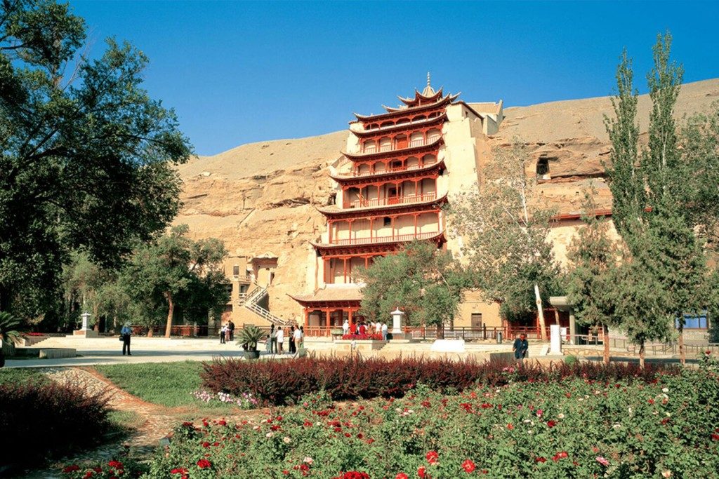
Carved into the cliffs above the Dachuan River, the Mogao Caves south-east of the Dunhuang oasis, Gansu Province, comprise the largest, most richly endowed, and longest used treasure house of Buddhist art in the world. It was first constructed in 366AD and represents the great achievement of Buddhist art from the 4th to the 14th century. 492 caves are presently preserved, housing about 45,000 square meters of murals and more than 2,000 painted sculptures. Cave 302 of the Sui dynasty contains one of the oldest and most vivid scenes of cultural exchanges along the Silk Road, depicting a camel pulling a cart typical of trade missions of that period. Caves 23 and 156 of the Tang dynasty show workers in the fields and a line of warriors respectively and in the Song dynasty Cave 61, the celebrated landscape of Mount Wutai is an early example of artistic Chinese cartography, where nothing has been left out – mountains, rivers, cities, temples, roads and caravans are all depicted.
As evidence of the evolution of Buddhist art in the northwest region of China, the Mogao Caves are of unmatched historical value. These works provide an abundance of vivid materials depicting various aspects of medieval politics, economics, culture, arts, religion, ethnic relations, and daily dress in western China. The unique artistic style of Dunhuang art is not only the amalgamation of Han Chinese artistic tradition and styles assimilated from ancient Indian and Gandharan customs, but also an integration of the arts of the Turks, ancient Tibetans and other Chinese ethnic minorities. Many of these masterpieces are creations of an unparalleled aesthetic talent.
The discovery of the Library Cave at the Mogao Caves in 1990, together with the tens of thousands of manuscripts and relics it contained, has been acclaimed as the world’s greatest discovery of ancient Oriental culture. This UNESCO World Heritage Site provides invaluable reference for studying the complex history of ancient China and Central Asia.
- Zhangye Danxia National Geopark-the Earth's Palette
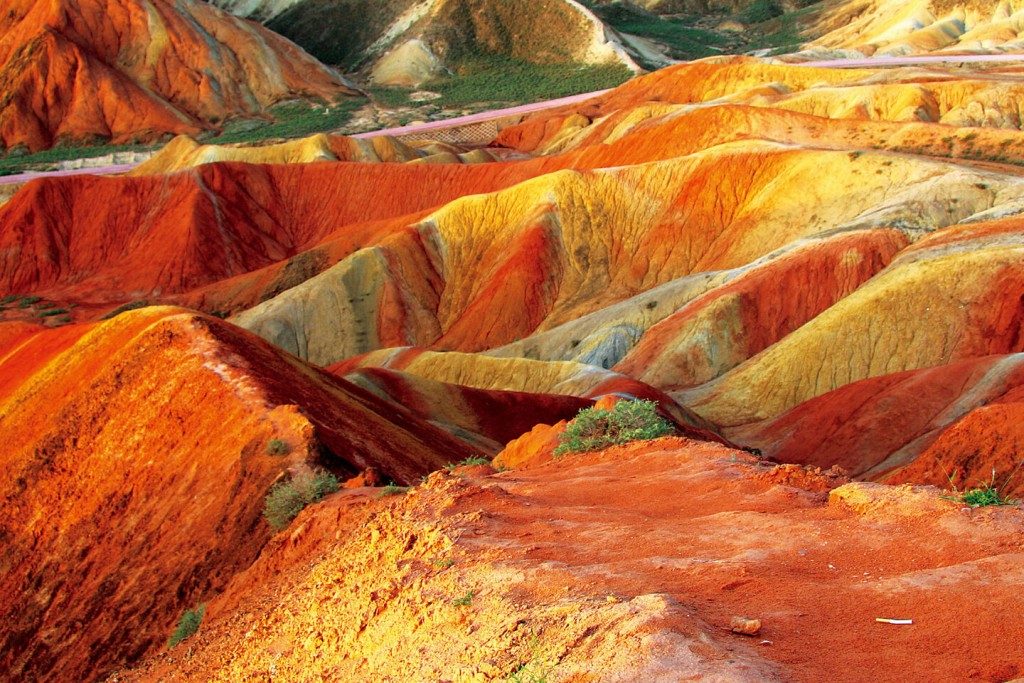
The Rainbow Mountains of China within the Zhangye Danxia Landform Geological Park are a geological wonder of the world. These famous Chinese mountains are known for their otherworldly colors that mimic a rainbow painted over the tops of rolling mountains. An exploration in the park would lead you to the diagenetic and mineralogical processes that make up the reds, greens, yellows, and blues. The site was named a UNESCO World Heritage Site in 2009.
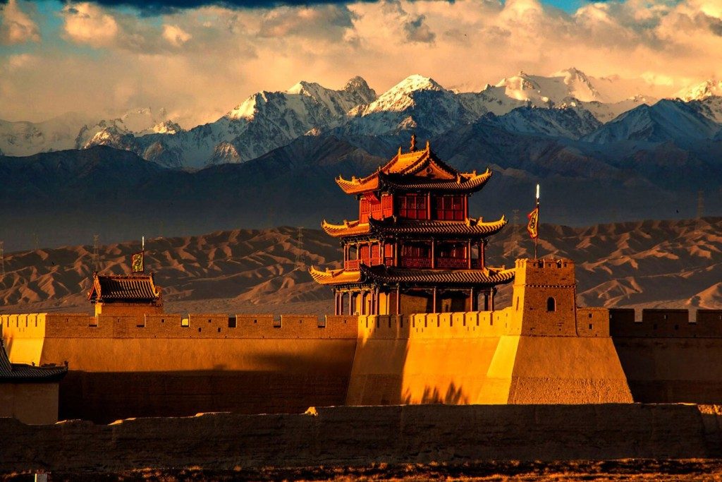
- Jiayuguan the Pass in the Desert
Jiayuguan is a pass standing at the western end of the Ming Dynasty Great Wall. Different from the well-known sections built with stones or bricks, Jiayuguan Great Wall was built with rammed earth, making yellow its dominant hue and helping the pass blend harmoniously with the surrounding desert. The city where the pass is located is named after the pass, also called Jiayuguan, sitting in China’s northwest Gansu Province.
Covering an area of 33,529 square meters (40,100 square yards), Jiayuguan Pass of Great Wall has a complex and integrated defensive system: an inner city, the central area with many buildings, an outer city, and finally a moat. You can also find common military facilities such as arrow towers, turrets, and cannons along the wall.
The ramparts and gate towers are the best viewing points to admire the surrounding scenes. Standing on the tower, it feels like you are alone in the vast desert with snow-capped Qilian Mountain in the distance. It’s a perfect frontier experience.The best time to take pictures is at sunset. The old pass looks magnificent with the scarlet sunlight slanting across the land.
Giant Buddha Temple in Zhangye
Overhanging Great Wall
Moon Spring Scenic Area
Silk Road Flower Rain
Yellow Noodles With Donkey Meat
03. Ningxia Hui Autonomous Region
The Ningxia Hui Autonomous Region, also called Ning for short, is one of China’s five autonomous regions for ethnic minorities. It has a population of 5.6155 million, more than one-third of whom are the Hui people while the rest being of 20 other ethnic groups, including Han, Manchu, Mongolia, Korea, and Dongxiang. Located in the eastern part of Northwest China, Ningxia borders Shaanxi Province in the east, Gansu Province in the south, and the Inner Mongolia Autonomous Region in the north. Covering an area of 51,800 square kilometers, it features a diverse topography. It has the precipitous Helan Mountains in the northwest, the vast Tengger Desert in the west, the tree-carpeted Liupan Mountains in the south, and the Ordos Basin, about 1,100 meters above sea level, in the northeast.
Ningxia abounds in energy sources and enjoys exceptional advantages in coal and water conservancy. It greatly benefits from the Yellow River, which runs 397 kilometers through the autonomous region and irrigates more than 300,000 hectares of farmlands. Its major crops are wheat and rice, and its economic crops include sugar beet, medlar, sesame, melons and fruit. Its animal husbandry is prosperous. The Ningxia Beach Sheepskin has won a worldwide fame.
Ningxia has a long history. As early as the late Paleolithic Age, man began to live here. During the Qin Dynasty (221-206 B.C.), in order to defend the nation from the invasion of northern nomadic people, the emperor ordered the construction of the Great Wall in this area, and in order to develop agriculture, people dug channels and thus started Ningxia’s history of drawing water from the Yellow River for irrigation. Since then, Ningxia has been noted for its scenery that can match that south of the lower reaches of the Yangtze River. During the Song Dynasty (960-1279), Dangxiang Tribe rose and gradually expanded its strength to be equal to the Song. In 1038, its chieftain, Li Yuanhao, formally came to throne and founded the Xia Kingdom. He established capital in Xingqingfu (present-day Yinchuan), set up an official system, and created characters of its own. Occupying the northwestern regions, Xia confronted Song, Liao, and Jin for a period until 1227, when it was perished by Genghis Khan. During the Yuan Dynasty (1279-1368), the court opened Ningxia Road here, starting the name of Ningxia. Then, the Ming court set Ningxia Defence, and the Qing court set Ningxia Prefecture. On October 25,1958, the Ningxia Hui Autonomous Region was established. At present, it governs four prefecturelevel cities, two county-level cities, and 15 counties.
Home of the Hui ethnic group, Ningxia is widely inhabited by the Hui people, who are famous for their diligence, intelligence, and cleanliness. The Huis believe in Islam and strictly observe the religious customs. They mostly use the Han language, except for a few erudite imams who are well versed in Arabian language. In their daily speaking; they occasionally use a few Arabian or Persian words or phrases.
In Ningxia, mosques can be found in every large Hui communities.
Men of the Hui group like to wear white or black edgeless caps. In hot weather, they wear a white shirt inside and a black gown outside, with clear white-and-black distinction. Women cover their heads with veils, so as not to reveal their hair, ears, and necks. According to their ages and marital status, the veils vary in color. Generally, the elderly wear white veils and the middle- aged wear black veils, while young girls or single women wear green veils.
- Shahu (Sand Lake) Tourist Zone
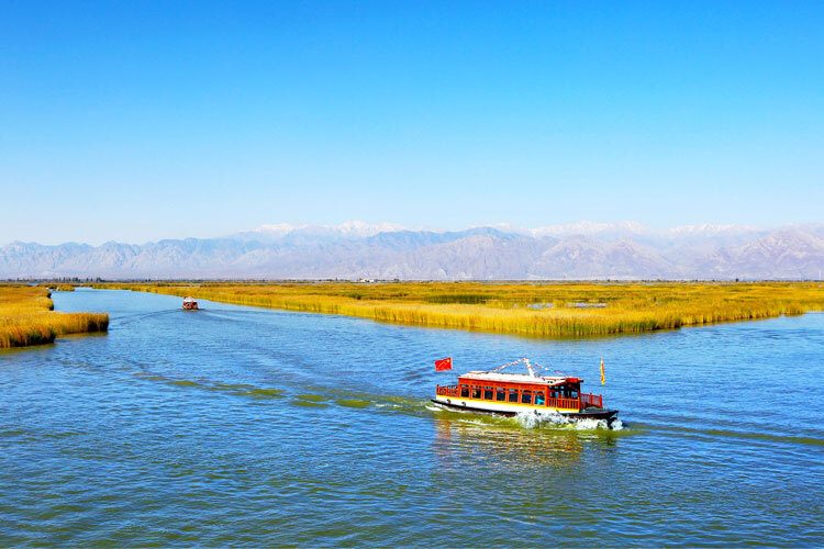

Located 42 kilometers north of Yinchuan, it is a famous scenic zone that integrates water town sceneries of South China with desert landscapes of the north. It is a paradise for birds and fishes as well as a fairyland for tourists. Tens of thousands of birds of dozens of species, such as the white crane, black marabou, and swan, inhabit here. Its central scene is a vast lake, namely Sand Lake, which is set off by an expanse of desert to the south.
- Shapotou (Sand Slope)
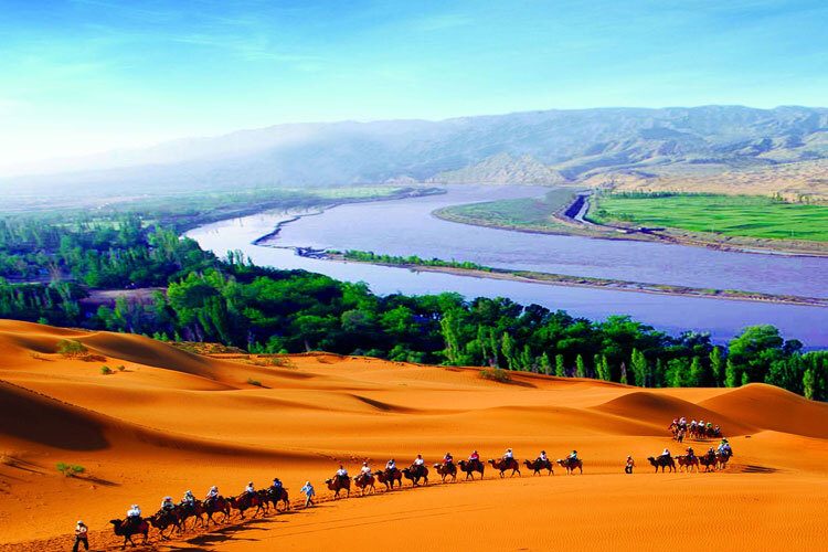
Twenty-two kilometers west of the county seat of Zhongwei, Shapotou faces the Tenggeli Desert in the north and the Yellow River in the south and embraces an oasis in the center. It is a resort for sand sliding. While sliding from the top of the sand hill, tourists can hear awesome sound like that of drum and bell. Tourists can also ride camels to travel the depth of the Tenggeli Desert.
- Cliff Paintings on the Helan Mountains

At the mountain foot of Helan some 50 kilometers from Yinchuan, there are tens of thousands of paintings carved by ancient nomadic tribes on cliffs and rocks, dating to 6,000 years ago. The paintings are mostly devoted to human faces, handprints, and hunting and sacrificing images, as well as various animals.
Huanghe Tower
Western Xia Mausoleums
Xiaoguan Tower
Yellow River Rafting
Lamb Meat
04. Qinghai Province
Qinghai Province, Qing for short, is named after China’s largest inland saltwater lake – Qinghai Lake – in its territory. Qinghai Province, located in northwestern China and on northeastern Qinghai-Tibet Plateau, is one of the largest provinces in China, and its provincial capital is Xining.
Towering mountains, diverse terrain, numerous rivers and lakes are all over Qinghai. It boasts the lofty Kunlun Mountains across the middle, Tanggula Mountains stand south. Qilian Mountains in the north, with undulating prairie and Qaidam Basin stretching out of the horizon. Qingpai Province, the birthplace of the Yangtze River, the Yellow River and the Lancang River, has long been credited as the “water tower of China”. The plateau boasts of rich biological resources, such as the rare Tibetan antelope known as the “Plateau Elf’.
The climate in Qinghai is plateau continental climate, cold in winter and cool in summer with less rainfall, long hours of sunshine, large temperature difference between day and night. The period from May to September is the best season for traveling in Qinghai every year.
There are many historical sites in Qinghai, including the world-famous Tangfan Trackway and Silk Road. The collision of Eastern and Western civilizations forms the unique plateau culture, multi-ethnic culture, and broad religious culture. Over forty ethnic groups inhabit here, each with a long and rich history, culturally distinct from the others.
Welcome to experience the mysterious Qinghai culture and meet these hospitable, industrious and honest Qinghai people, taking an enjoyable trip in the real nature.
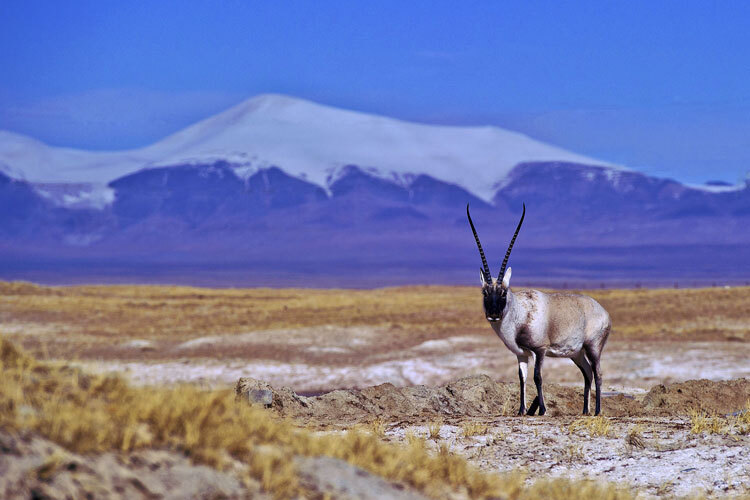
- Kekexili
Kekexili is one of the best persevered original ecological environment zones in the world. The average altitude of this place is around 5,000 meters with dry and cold climate, severe shortage of hypoxia and fresh water and perilous environment. But it is a home for Tibetan antelopes, Tibetan wild donkeys, wild yaks and Tibetan snow cocks and other highland wildlife.
- Qinghai Lake
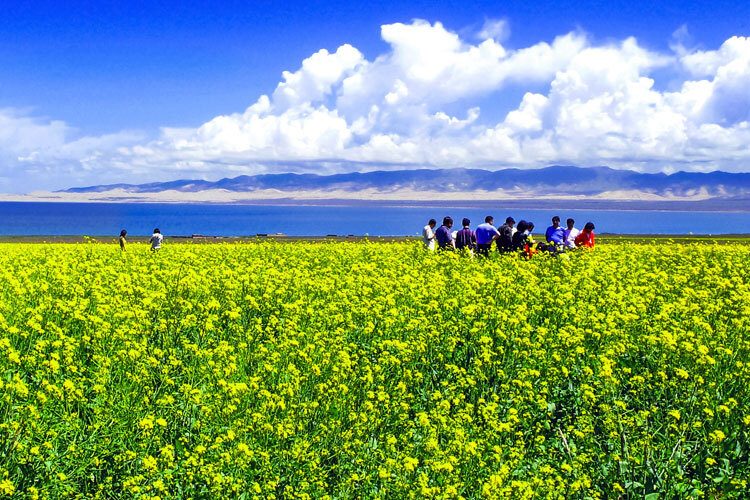
Qinghai Lake, China’s largest inland lake and the largest saltwater lake, is surrounded by mountains on three sides with magnificent sceneries. Plateau lakes and grasslands, snow-capped mountains and desert made up the main landscape of this area. Main attractions of Qinghai Lake include the Bird Island, the Center Island, Sand Island, Erlangjian, and Fairy Bay.
- Ta'er Monastery
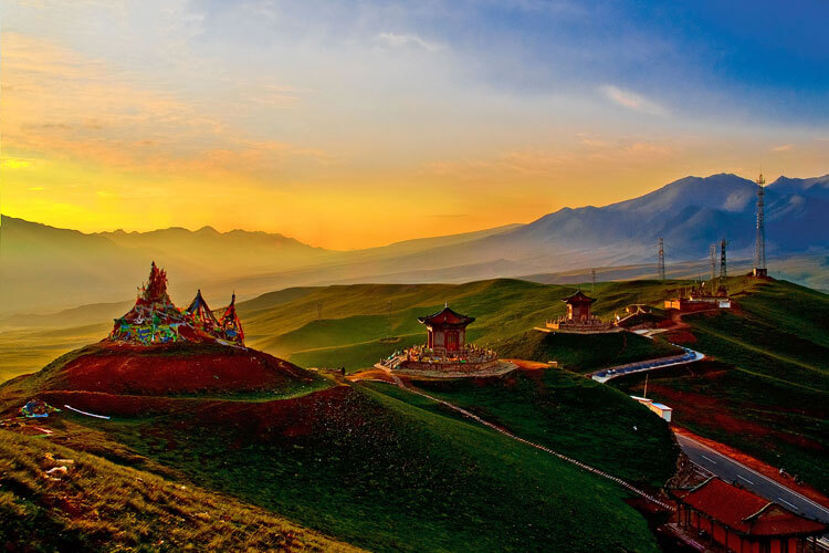
As the biggest monastery of Tibetan Buddhism in Qinghai Province, Ta’er Monastery comprises of the Han and Tibetan art styles with more than 1,000 yards and 4,500 halls and temples such as the Great Golden Roof , the Small Golden Roof, the Longevity Ha ll, the Great Hall and Ruyi Tower. Ta’er Monastery is rich in fascinating arts. The famous murals, the barbolas, and the butter sculptures are considered to be the three most unique arts of superb craftsmanship.
Old Gui'de
Qarhan Salt Lake
Oberyan Yadan Landform
Tu Nationality Embroidery
Roast Lamb
05. Xinjiang Uygur Autonomous Region
Located at the northwestern border of the People’s Republic of China, Xinjiang Uygur Autonomous Region, “Xin” for short, covers an area of 1.66 million square kilometers, one-sixth of the Chinese territory. Its land border extends some 5,600 kilometers, neighboring with eight countries including Russia, Kazakhstan and Tajikistan, etc. With Urumqi as its capital, the autonomous region is home to 47 ethnic groups including the Han, Uygur, Mongolian, Kazak and Hui.
Xinjiang boasts unique geological environment and rich tourist resources. With Allay, Tianshan and Kunlun Mountains surrounding the Junggar and Tarim Basins, this part of the world is dotted with high mountains, basins, lakes, grasslands, Gobi desert and snow-capped mountains. Tianshan Mountains, the symbol of Xinjiang, is also known for its ice-crowns, forming unique glacier scenery. The famous Silk Road passes through the region in southern, central and northern routes, leaving behind numerous places of historical interest, such as the ruins of Ancient City of Loulan, Gaochang Ancient City, Karez Well (irrigation system of wells connected by underground channels), and the Tomb of Fragrant Imperial Concubine. These, plus a mixed culture formed in some 1,000 years, i combine to make Xinjiang a must-visit place.
Xinjiang is also richly endowed with resources. Its melons, grapes and pears are much coveted in and outside China.
Richly endowed with natural resources and blessed with beautiful landscape and mysterious culture, Xinjiang has a magnetic pull to the visitors.
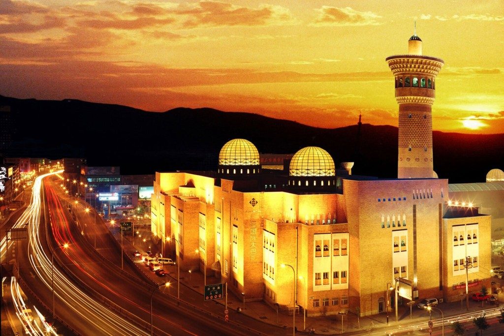
- Urumqi International Grand Bazaar
As a fast-growing Central Asian hub, the city does business with traders from Běijīng to Baku and plays host to an exotic mix of people. Indeed, it’s hard to imagine where else in the world you’ll see Chinese, Arabic, Latin and Cyrillic script so commonly side-by-side. This truly is Central Asia.
Urumqi is not a historic city, but its museum is excellent and there are some atmospheric Uyghur districts. Most travellers pass through the provincial capital at some point, and many find their stay to be surprisingly enjoyable.
- Flaming Mountain
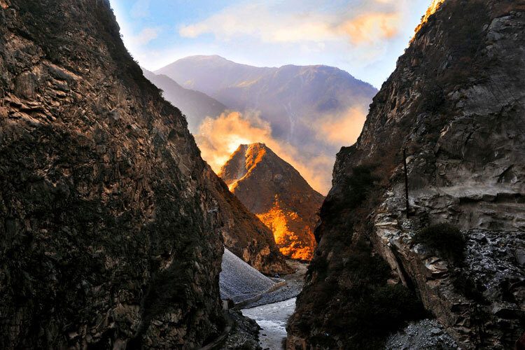
The Flaming Mountain lies in the northern part of the Turpan Basin. It is so called mainly because it takes the purple red color which looks like burning fire under scorching sun. The Grape Gully in the mountain, 15 kilometers from downtown Turpan, is shaded by green trees. It is famous for seedless grapes.
- Taklimakan Desert
The longest highway through a desert in the world is in Xinjiang. It starts in an oilfield in Luntai County, goes throuth Taklimakan Desert and ends in Minfeng County in the south. The 565-kilometer-long highway is protected with a perfect system to stabilize sand with fence and checkered laceworks of straw. Tourists can appreciate various natural sceneries in the Taklimakan Desert along the highway, such as sand dunes, sand ridges and sand gullies. Diversiform-leaved popular groves, branchy tamarisk bushes and reeds in the desert present an unusual charm.